
Help researchers determine accuracy of satellite data by capturing and uploading ground observations from your phone.
Want more citizen science? There’s an app for that.
We may not realize it, but artificial satellites are responsible for so many aspects of our daily lives. They dictate our ability to communicate with one another, assist in the navigation of aircraft and ships, monitor and deliver top-secret military information for our security and protection, and track atmospheric and weather changes.
The ability to track weather patterns is an important tool in our daily lives—on one hand, we can figure out whether to bring an umbrella, or wear an extra layer of clothing. On the other hand, the government, organizations and individuals can plan (and if necessary, evacuate) for extreme weather conditions, such as storms and tornadoes. Tracking these changes over the long term is also necessary to determine the impact of climate change. For these reasons, data that is used to track weather patterns needs to be accurate.
However, even technologically advanced satellite monitoring systems have issues with resolution. For example, sometimes the satellite cannot discern between cloud covering and snow. To resolve this issue, a team led by Liam Gumley at the Space Science and Engineering Center (SSEC), in the University of Wisconsin-Madison, developed SatCam (official site), a free iOS app designed to verify images taken by three Earth-observing satellites:
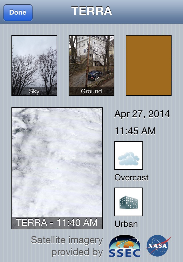
Terra – a NASA satellite that collects data about earth’s changing climate;
Aqua – a NASA satellite that collects data about the earth’s water cycle;
Suomi-NPP – a NASA, the National Oceanic and Atmospheric Administration (NOAA) and the Department of Defense (DoD) satellite that collects long term climate change and short-term weather data.
With SatCam, anyone with an iPhone, iPad or iPod Touch can become a citizen scientist and verify satellite images. The app alerts the user when a satellite is approaching. Once the user is outdoors and once the satellite is in range, point the device at the sky and the app will automatically take a picture. SatCam will prompt the user to take a picture of corresponding horizon, classify the cloud conditions (cloudy, overcast or clear) and classify the ground conditions (urban or vegetation). Once the data is submitted and processed, the app’s “history tab” displays the user’s data and the satellite’s image of the same location on one screen. If you have ever wondered what your neighborhood looks like from over 700km (435 miles) away, you can find out with SatCam.
The first SatCam images were recorded in May 2012. Within two years, over 10,000 images have been recorded from locations all over the world. Margaret Mooney, the Education and Public Outreach Director of the Cooperative Institute for Meteorological Studies (part of the SSEC), said that the app “has taken a life of its own” due to promotion at conferences and Facebook, and it “raises awareness of satellites and of the local environment, and provides ground-truth” to the data obtained by satellites. Educators can employ SatCam as an educational tool, in conjunction with other science educational programs such as GLOBE.
SatCam’s team hopes to expand the app’s capabilities in the near future. According to Mooney, SSEC has submitted a proposal for NASA’s Air Quality group, which would incorporate the ability to record air quality data within the app.
More information:
Images: SSEC
Rae Moore has a BS in Chemistry from McMaster University and studied Bioinorganic Chemistry as a PhD student at McGill University. She has also been a cheerleading coach, yoga teacher, and preschool science educator. Now she focuses on science education and advocacy, and blogs about scientific job searching on her blog, ThereOnceWasaChemist.com.